Box wind measuring systems currently in use
Besides contacting your local/national meteo department, three fundamental systems are currently being used at CIVA events for measuring the box wind:
- Drone or Quadracopter with a GPS transmitter
- Slow flight and GPS measurement of ground speed
- Helium-filled balloons - tracked by a ground-based theodolite, or carrying a GPS transmitter
Taking these in turn -
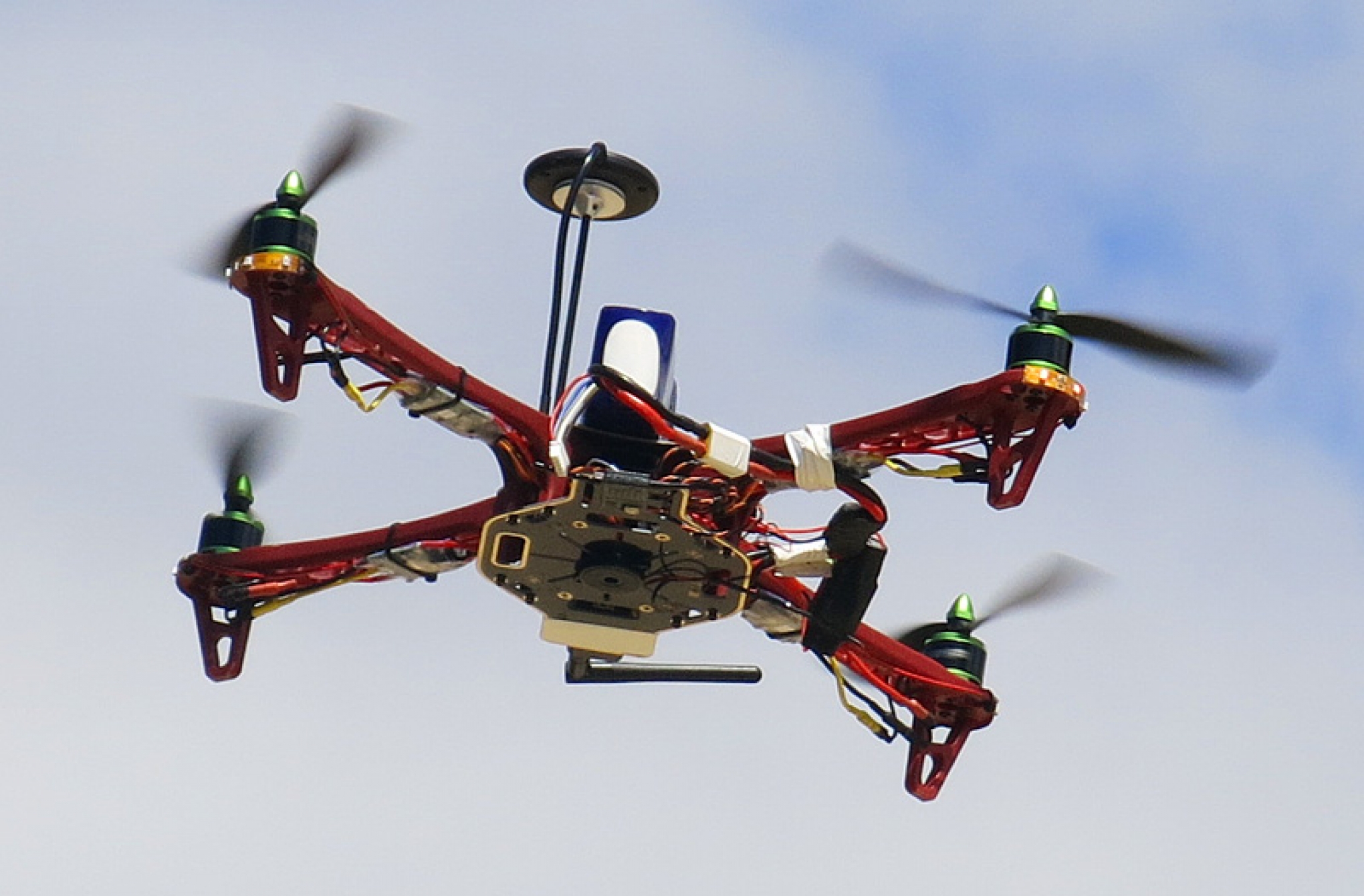 1. Drone or Quadracopter with a GPS transmitter. A specialised quadracopter has been created with on-board GPS and a control system that enables complete flights to be made to quickly and accurately measure the wind speed and direction as required. It is capable of completing the task in wind speeds up to 70km/h though higher wind speeds tend to limit the perfomance envelope. The 'copter can be programmed to carry out completely automated flights, or can be partly/fully manually controlled as required. It is not generally visible at heights above 500m, so a combination of modes is generally used. Note that quadracopter flights to the height required for this duty may require special permission from your national Civil Aviation Authority.
2. Slow flight and GPS measurement of ground speed. For CIVA glider events Section-6 part-2 describes a procedure that requires a slow flying aircraft to accurately fly north, south, east and west while using a GPS to determine the true ground speed. A method is given to calculate the wind speed from the recorded data. This process of course requires the use of a suitable aircraft, a GPS and a pilot who can fly precise headings and simultaneously record the necessary GPS ground-speed data. The subsequent calculations are simple and may be carried out in flight, but the process must be carefully planned to provide a slick response when needed. Section-6 part-1 (power) does not provide this option.
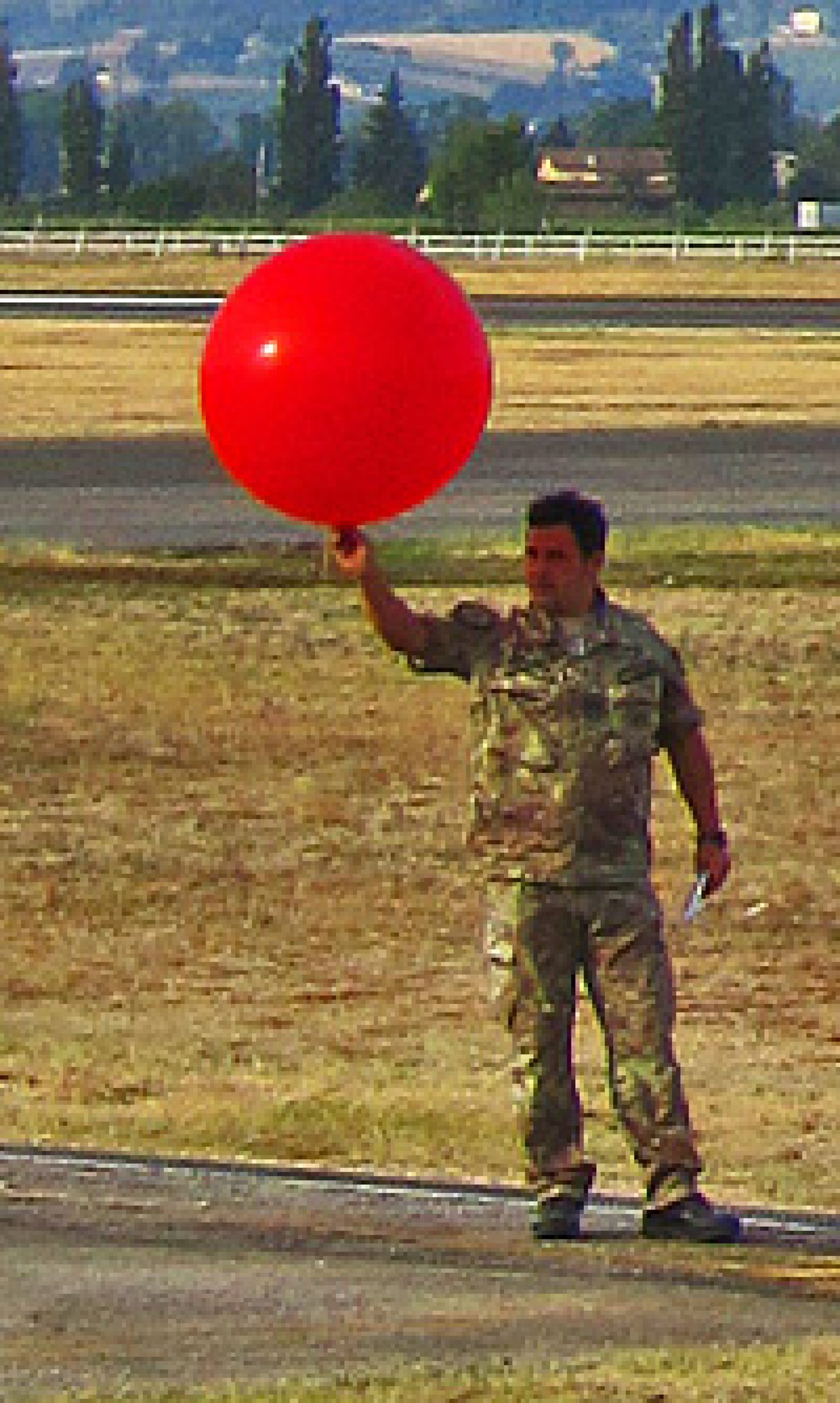 3a. Balloons and a Theodolite. This function is normally carried out by a bought-in professional service. A company specialising in wind measurement will be contracted by the organiser, the service provider being responsible for the supply and operation of a special type of helium-filled balloons which are released from an agreed location near the box and then tracked by an expert with a theodolite. Azimuth, distance and horizontal vector readings of the balloon's ascent are taken at regular intervals, and calculations provide the wind direction and velocity data at the required altitudes.
This solution is long established, suitably accurate for the purpose, and can be slick in operation. However the cost of the professional service plus the non-retrievable balloons and helium gas throughout the event can be significant.
3b. Balloons and a GPS transmitter. First trialled in 2014, a lightweight GPS receiver/transmitter / control system is mounted in a styrofoam cup suspended below a traditional helium-filled balloon. During the balloon's ascent the transmitter feeds back continuous data to the operator's laptop via a G4 mobile telephone frequency. At a designated altitude the styrofoam cup is detached from the balloon and parachutes to the ground, where the system emits a signal to facilitate its location and retrieval. The balloon alas is lost ...
This solution provides an excellent data stream. It is relatively simple to use, but it still requires a supply of specialist helium-filled balloons which can represent a significant cost. If the local terrain is 'difficult' (viz. South African bush country) it may not always be possible to locate and retrieve the styrofoam cup, rendering this approach unsuitable.